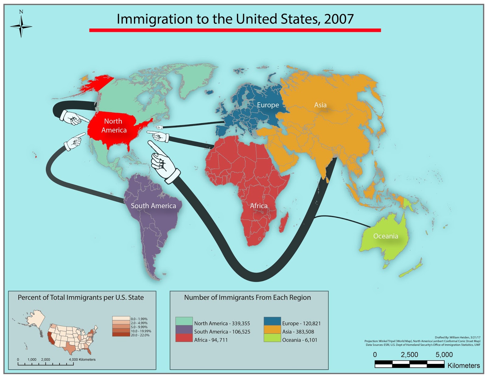
As seen in the map, the flow lines are of varying widths. This is because the data is quantitative, as the varying widths can be used to represent varying values. The widths were calculated with ease using Excel's formula creating abilities, beginning with the square root of the 2007 immigrants from each region. Next, the proportional line size was calculated using the following formula:
Width of line symbol = (maximum line width) x (SQRT value/ SQRT maximum value). The width of each flow line could then be adjusted within AI.
Design wise, the light blue background and flow lines have had their opacity reduced, which created softer colors. The continents and regions are of darker color, along with an added outer glow to create depth. Both the legend and inset map were created in AI, which allowed for great customization. I went with pointing hands instead of arrows, as I thought they were humorous but also since the fingers had substantial length, it allowed for less cluttering compared to the arrows.
This was a fun assignment, although time consuming initially until I had settled on a particular style. This is an excellent case in how exposure to other maps for inspiration is key. It also represents the numerous possibilities and configurations possible in creating such a map. Not only with varying colors but even with placement of the continents and styling of flow lines.
Comments
Post a Comment