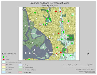
For this lab, we used our original land use and land cover map. However, the areas that were classified needed to be verified through ground truthing. Since we aren't able to physically visit the area, Google Earth's street view was utilized. I created a shapefile with a new column and designated sampled areas a 1 for true and a 0 for false. I exported these into the previously created geodatabase. I ended up with 80% accuracy, as can be seen in the image provided.

Comments
Post a Comment